

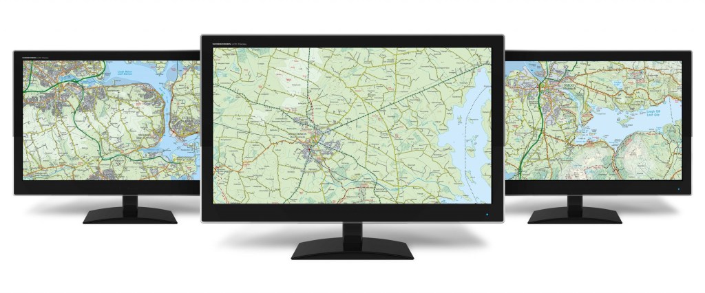
At a scale of 1:50,000, this is a digital version of the Discovery mapping series, originally designed for tourist and leisure activities. It has proved to be a popular and beneficial backdrop layer for many of our digital users and contains all the features and information that is found on our paper product. A significant amount of forestry, trails, waymarked walks and summit information (including third party contributions) has been collated to enhance the value of the Discovery Series to the outdoor and GI community.
There are 250 tiles in the series (Republic of Ireland). Additional tiles produced by Land & Property Services (formerly Ordnance Survey NI) are available for Northern Ireland.
Each tile covers a ground area of 20km x 20km, and all are available in Irish Grid (IG) or ITM Irish Transverse Mercator (ITM) raster format and are ideal for backdrop mapping in GIS applications.
A digital representation of the market leading Discovery series of maps an ideal tool for highlighting your location through a website or organising a sporting event.
For further information or to purchase a Discovery Series Digital Extract contact digitals@tailte.ie . Paper editions are also available in our online store or by contacting mapsales@tailte.ie .
The Discovery Series Legend can be downloaded here.