Map of Phoenix Park, Dublin Formula 1 track

The event itself and “moving monuments”

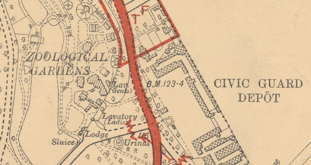
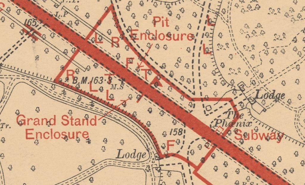
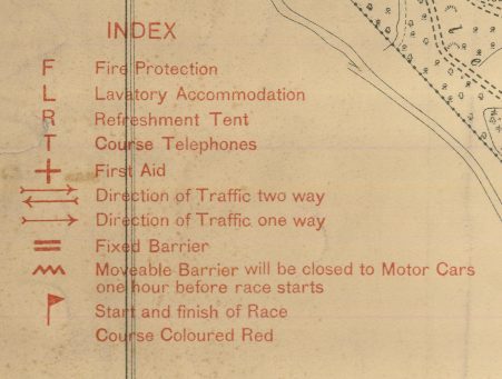
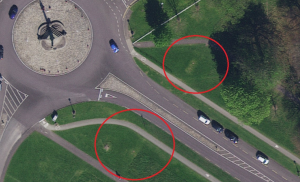
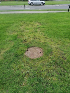
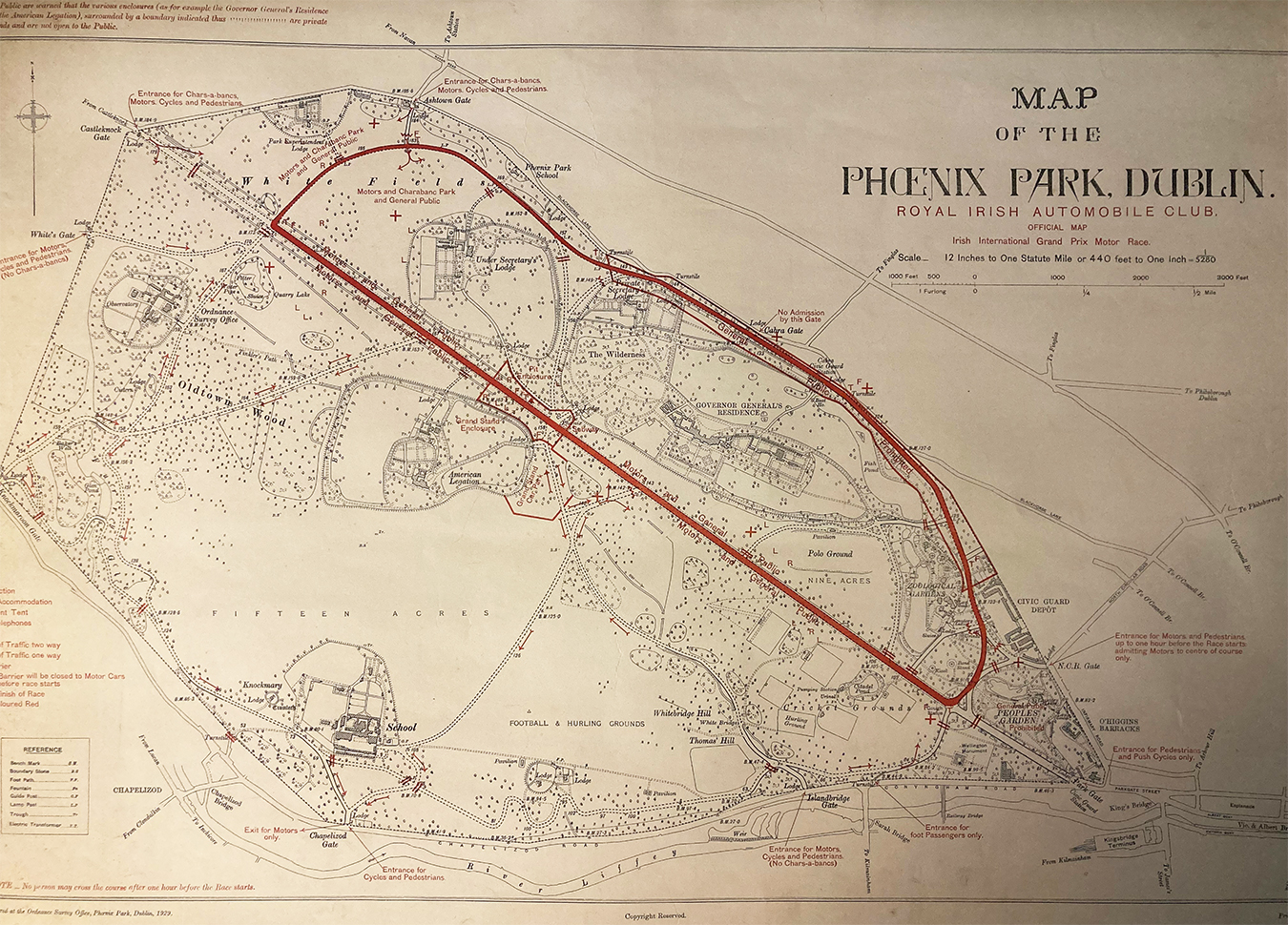
The scale of the Grand Prix was the first of its kind in Ireland. The 2-day event was held over 3 years on a 4.25 mile circuit laid out in the expansive grounds of The Phoenix Park in Dublin. The Park provided the perfect setting for the circuit – the long straight of Chesterfield Avenue, with tighter stretches of road along the outer edges of the park. The speed trials in 1903 provided the route for the races – starting just before the Viceregal Lodge(Áras an Uachtaráin) and travelling in a clockwise direction down Chesterfield Avenue, around Mountjoy corner and heading back up the North Road towards the people’s park and Parkgate street before taking a loop back round to the finish line. The Government even granted permission to temporarily remove the Phoenix Monument for the events as it was directly in the path of the race circuit. Grandstands stretching over 250 yards were erected along the route to add to the race atmosphere. To mark this great occasion, a special map was published by Tailte Éireann (formerly OSi) in 1929.

The commemorative map contained features and labels relating to the Grand Prix which were printed in red. The marks were superimposed on the standard map of the Phoenix Park scaled to fit on a single map sheet, for ease of use. Focusing on cartographic simplification in buildings and other features, it can be noted that the Grand Prix map is a revised version of earlier 6-inch maps of the Phoenix Park enlarged to a scale of 12 inches to 1 mile and printed in black and white.

This atypical scale was chosen because on a 6-inch map, the park would appear too small and additional features would be cluttered and difficult to read and a 25-inch map would have spread the park over several sheets.

You can see in these images, the addition of a subway under Chesterfield Avenue next to The Phoenix Monument. Labelled in red, this feature was created especially for the Grand Prix and superimposed on the existing maps.  The subway is the only permeant feature shown in red.

Letters and symbols show the location of temporary facilities and features including Fire Protection, Telephones, First Aid Stations and Barriers.

What trace of the subway can you see today?

The subway appears in later maps and was used during Pope John Paul II visit to the Phoenix Park in 1979. While the subway has since been filled in, some traces of it are still visible today.

 An aerial image of what is left of the subway entrances on Chesterfield Avenue today

An aerial image of what is left of the subway entrances on Chesterfield Avenue today

 Traces of the subway entrance can be found on Chesterfield Avenue

Traces of the subway entrance can be found on Chesterfield Avenue